
MEGALITHS > HUNEBED ATLAS > F1


DRENTHE HUNEBED MAP

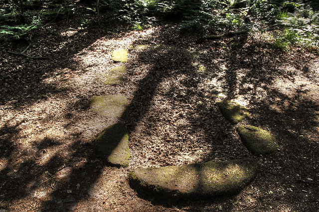
F1 Rijs
Type: Passage grave
Size: 5.5 x 2 m
Town: Rijs
Location: Rijsterbos
Latitude N: 52.8555
Longitude E: 5.48846
Orientation: 88° (90° = E-W)
First reported 1849 H.W. Kouwenhoven (via L.J.F. Janssen)
Plumb stones mark the locations of the original orthostats of the only hunebed found in the province of Friesland. It originally had four large capstones, with an entrance on the long southern side, but the stones were all carried off for road-builkding after its discovery in 1849. It sits deep in the bush in the heart of an oak and birch forest that has since grown around it in the coastal region of Gaasterland.
 Hunebed Map: Photos, info, location maps
About the Megaliths: The Neolithic heritage
Megalith Slideshows: Old stones of Europe
F1 Rijs
Type: Passage grave
Size: 5.5 x 2 m
Town: Rijs
Location: Rijsterbos
Latitude N: 52.8555
Longitude E: 5.48846
Orientation: 88° (90° = E-W)
First reported 1849 H.W. Kouwenhoven (via L.J.F. Janssen)
Plumb stones mark the locations of the original orthostats of the only hunebed found in the province of Friesland. It originally had four large capstones, with an entrance on the long southern side, but the stones were all carried off for road-builkding after its discovery in 1849. It sits deep in the bush in the heart of an oak and birch forest that has since grown around it in the coastal region of Gaasterland.