
MEGALITHS > HUNEBED ATLAS > D24
D24 Bronneger | Click images to enlarge | << Back to Hunebed Map


- Photo 1
- Photo 2
- Ground Plan
- Location Map
DRENTHE HUNEBED MAP

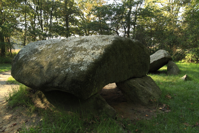
D24 Bronneger
Type: Gallery grave
Size: 6.7 x 2.4 m
Town: Bronneger
Location: Steenakkers
Latitude N: 52.944782
Longitude E: 6.802482
Orientation: 112° (90° = E-W)
First reported 1711 Ludolph Smids Schatkamer der Nederlandsse Oudheiden
Very much dilapidated, D24 is the middle triplet between the larger D25 and smaller D23, with which it forms a triangle. It is in the bush outside Bronneger, near D21 and D22, and the five were likely part of a larger complex, most of which is now lost.
Same group:
D21 | D22 | D23 | D25
 Hunebed Map: Photos, info, location maps
About the Megaliths: The Neolithic heritage
Megalith Slideshows: Old stones of Europe
D24 Bronneger
Type: Gallery grave
Size: 6.7 x 2.4 m
Town: Bronneger
Location: Steenakkers
Latitude N: 52.944782
Longitude E: 6.802482
Orientation: 112° (90° = E-W)
First reported 1711 Ludolph Smids Schatkamer der Nederlandsse Oudheiden
Very much dilapidated, D24 is the middle triplet between the larger D25 and smaller D23, with which it forms a triangle. It is in the bush outside Bronneger, near D21 and D22, and the five were likely part of a larger complex, most of which is now lost.
Same group:
D21 | D22 | D23 | D25